Parks & Sancturies
National Parks & Sancturies in KERALA
Eravikulam National Park
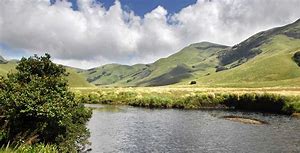
Perched 7000 ft. above sea level, is break taking in the size and diversity of flora and fauna. A former hunting preserve of the British planters, the Park today exemplifies wildlife at its best. It was declared a Sanctuary in 1975 with the intention of protecting the indigenous population of Nilgiri Tahr (highly endangered mountain goat). However, in 1978, it was declared as a National Park considering it’s ecological, faunal, geomorphological and Zoological Significance. This is also the land of “Neelakurinji”, the flower that blooms once in twelve years. The Park is breath takingly beautiful and is easily comparable to the best of mountain ranges in the Alps. With the highest peak south of the Himalayas – the Anamudi, located here, nature enthusiasts have ample opportunities for trekking expeditions and wildlife spotting.
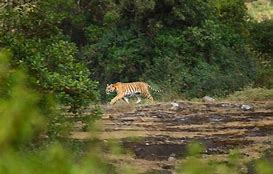
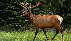
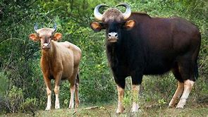
Extent The Park covers an area of 97 Km2 of rolling grasslands and high level sholas. Year of formation: 1978 Climate The Park receives heavy showers during the southwest (June/July) and retreating (October/November) Monsoons and is one of the wettest area of the World. April & May are the hottest months. The occurrence of frost is quite common during the winter (December to February) Topography The terrain is undulating with grass, hillocks, and sholas. In addition the highest peak south of the Himalayas – The Anamudi, which is 2695 meters in height is situated on the southern side of the Park. Vegetation The major part of the park is covered with rolling grasslands, but several patches of shola forests are also found in the upper part of the valley. Important flora includes Actinodaphne bourdilloni, Microtropis ramiflora, Pittosporum tetraspermium, Sysygium aronottianum, Chrysopogon Zelanieus, Eupatorium adenophorum, Strobilanthus Kunthianus (Neela Kurinji), Eulalia phaeothrix, Tripogen bromodes, Arundinella fuscata, Cyanotis Species etc. The shola grasslands are exceptionally rich in balsams and orchids including the long thought extinct variety Brachycorythis wightii. Wildlife Population 29 Species of mammals are found here of which 5 are endemic to the Western Ghat’s. The Nilgiri Tahr, Gaur, Sloth Bear, Nilgiri Langur, Tiger, Leopard, Giant Squirrel and wild dog are common. Half the world population of the endangered Nilgiri Tahr lives here. Panthers are usually sighted in the open grasslands while Civet cats and Jungle cats live in the Sholas. 140 species of birds of which 10 are unique to the Western Ghat’s. The Atlas moth, the largest of its kind in the world is seen in this Park. More than 100 varieties of butterflies have been recorded here. Besides 20 species of amphibians are also seen. Ecotourism Trekking and other activities at Eravikulam are limited to the tourism zone that is approachable by vehicle and is a high altitude rocky precipice. The view of the valley from here is fabulous and offers a satisfying trip for trekkers. A good pastime is the Lakhom Falls trail involving a one day trek from the water fall to Pakkumarathery where trekkers can have a look at the Anamudi Peak and opt for an overnight stay at the log house. Location Situated in Devikulam Taluk of Idukki District on SH17 (Udumalpet Road) 100 10’ - 100 20’ North and 770 0’ - 770 10’ East. Access Road:Eravikulam is nearly 15 Km north of Munnar and can be reached from Kochi (135 Km) and Kottayam (148 Km) by Road. Rail: The nearest railway station in Kerala is Aluva (120 Km from Munnar) and Coimbatore (165 Km) in Tamil Nadu. Air: The Park is accessible from Cochin (Kerala) and Coimbatore (Tamil Nadu) airports, which are located at about 148 Km and 175 Km respectively. Contact The Wildlife Warden Munnar PO, Idukki Dist.Kerala, India. PIN:685 612 Tel: 91-4865-231587,Mob:9447979093, E-mail: ww-munnar@forest.kerala.gov.in For Information on tourism please contact : Information Assistant -8301024187Silent Valley National Park
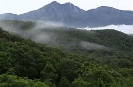
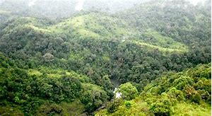
The core of the Nilgiri Biosphere Reserve, the Silent Valley National Park is probably one of the most magnificent gifts of nature to mankind, a unique preserve of tropical rain forests in all its pristine glory with an almost unbroken ecological history. Silent Valley is closed on all sides with high and continuous ridges and steep escarpments, as a result the valley is shielded from the extremes of climate as well as anthropogenic interventions and so it remained an ecological island with a special micro climate. The river Kunthi descends from the Nilgiri Hills above an altitude of 2000 m and traverses the entire length of the valley finally rushing down to the plains through a deep gorge.
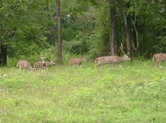
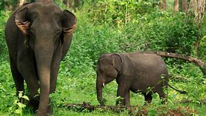
EXTENT Core area of 89.52 KM2 and buffer zone 148 KM2 Year of formation: 1984 CLIMATE The climate is tropical with summer rains constituting the bulk of the precipitation. Average minimum temperature varies from 8º to 14ºC. and average maximum temperature varies from 23ºto 29ºC . The hottest months are April and May when the mean temperature is 23 °C and the coolest months are January and February when the mean temperature is 18o C. Annual average rainfall is 2717 to 4543 mm. TOPOGRAPHY The terrain is generally undulating with steep escarpments and many hillocks. The elevation ranges from 900 M to 2,300 M above MSL with the highest peak at 2,383 M (Anginda peak). VEGETATION The Silent Valley is virtually a botanist’s treasure-trove. The flora of the valley include about a 1000 species of flowering plants, 107 species of orchids, 100 ferns and fern allies, 200 liverworts, 75 lichens and about 200 algae. Of these plants a good majority is endemic to the Western Ghat’s. Silent Valley Reserve Forest can be classified under four forest types viz., 1. West-coast tropical evergreen forest (600 to 1100 m), 2. Southern subtropical broad leaved hill forest (1300 to 1800 m), 3. Southern montane wet temperate forest (above 1900 m) and 4. Grassland. The following are some of the new species and genera recorded recently from Silent Valley. Hedyotis silentvalleyensis, Kanjaram palghatensis, Porpax chandrasekharanhii, Silentvalleya nairii, Nydnocarpus pendulus etc. New species of orchids recorded are Oberonia bisaccata, Liparis indiraii, Eriatiagii, Ipsea malabarica, a ground orchid rediscovered after a lapse of more than a century. Scutellaria oblonga and Anodendron rhinos porum, two Sri Lankan plants have also been recorded. The family Orchidaceae which is represented by more than 100 species at the Valley includes rare, endemic and highly endangered orchids as well. Ipsea malabarica, Bulbophyllum silenvalliensis, Eria tiagii are some of the rare orchids in the valley. Cullenia exarillata,Mesua ferrea,Palaquim ellipticum etc. are the major tree species seen here. WILDLIFE POPULATION National Park is rich in faunal diversity and harbours 34 species of mammals, 292 species of birds, 31 species of reptiles, 22 species of amphibians, 13 species of fishes, 500 species of butterflies and moths, besides a multitude of lower forms of animal life most of which are yet to be documented. The valley has a fair representation of all peninsular mammals. They are Lion-tailed Macaque, Nilgiri Langur, Bonnet Macaque, Tiger, Leopard (Panther), Leopard Cat, Jungle Cat, Fishing Cat, Common Palm Civet, Small Indian Civet, Brown Palm Civet, Ruddy Mongoose, Stripe necked Mongoose, Wild Dog, Sloth Bear, Otter, Flying Squirrel, Malabar Giant Squirrel, Indian Pangolin (Scaly anteater), Porcupine, Wild Boar, Sambar, Spotted Deer, Barking Deer, Mouse Deer, Gaur and Elephant. The most famous resident of the Park is Lion Tailed Macaque whose name has become almost synonymous with that of the Valley. A shy dweller of the canopy, this primate can be seen singly or in groups. The gracious macaque depends mainly on Cullenia exarillata fruits for their food. As Silent Valley has a large number of these trees; likely the survival of this highly endangered species is ensured. Of the 200 species of birds sighted and identified in the Valley, 14 are endemic to the Western Ghat’s.These are1. Nilgiri Wood Pigeon 2. Blue winged Parakeet 3.Greyheaded Bulbul 4. White bellied tree Pie 5. Rufous Babbler 6. Wayanad Laughing Thrush 7. Nilgiri Laughing Thrush 8. Broad tailed Grass Warbler 9. Black and Orange Flycatcher10. White bellied Blue Flycatcher 11. Nilgiri Flycatcher 12. Nilgiri Pipit 13. Small Sunbird and 14. Rufousbellied Shortwing. The major reptile seen here are King Cobra, Cobra, Viper, Krait, Rat Snake, Tree frog, Bronze frog, Rufescent Burrowing Frog, Indian Chameleon, etc. The river Kunthi and its tributaries harbor many forms of fresh water life.12 species of fish have been identified out of which two are new to science.19 species of frogs including 2 new species have been sighted from the valley Of the 128 species of butterflies identified in the Valley, nine are exclusive to the Western Ghat’s. The park also has a good representation of beetles, bugs, grasshoppers and other insects ACCOMMODATION Inspection Bungalow at Mukkali – 2 Bed Rooms (4nos) Large Rooms (2 Nos) – 7 beds Hut (2 suited) – 1 no Accommodation in suits and rooms will be available only on advance booking BEST TIME TO VISIT The ideal time to visit the Reserve is December-April Visiting Hours-8AM to 1PM LOCATION Silent Valley falls within the revenue districts of Palakkad and Malappuram within the 76º 24’ and 76º 29’ East Longitude and 11º 4’ and 11º 13’. North Latitude. ACCESS Air: Kozhikode-140 km, Coimbatore – 100 km. Rail: Palakkad – 58 km; Coimbatore – 90 km Road: Coimbatore – Anakkatty – Mukkali – 90km. Coimbatore – Palakkad – Mannarkkad – Mukkali – 120km Kozhikode - Palakkad – Mannarkkad – Mukkali – 120km CONTACT The Wildlife Warden Silent Valley Division, Mannarkkad.P.O, Palakkad, Kerala, India.PIN: 678 582 Tel: 04924-222056 e-mail: ww-svnp@forest.kerala.gov.in For more information please contact: Information centre Ph: :8589895652 Assistant Wildlife Warden Silent Valley National Park Range, Mukkali, Palakkad Kerala, India.PIN:678 582 Tel: 04924 – 253225 email: ro-mukkali@forest.kerala.gov.inPampadum Shola National Park
Considering the ecological, faunal, floral, geographical and zoological significance of Pampadum Shola, the Government of Kerala declared it as a National Park in December 2003 vide notification No: 12875/F2/2003/ F& WLD dated 14/12/2003.The Park is located in the eastern part of Southern Western Ghats of Kerala on the way to Vattavada, near Top Station about 35 Kms from Munnar town.
EXTENT 11.753 Sq. Km CLIMATE Enjoys misty and cloudy climate throughout the year. Months from April to September have pleasant climate and is the most popular time for tourism in this area. The coldest months are December and January when the minimum temperature inside forests fall up to 6°C even at lower elevations. The temperature varies with a minimum of 6°C (December) to a maximum of 30°C (April). There are 4-5 dry months spanning between December and March. Due to the location situated near to the Tamil Nadu State, Pampadum Shola Forests receive heavy rain in the North-East monsoon also. TOPOGRAPHY The terrain is undulating with hillocks of varying heights. The altitudes range between 1600-2400 m. The forest is seen as a continuous patch from 1600 m up to 2000 m, above which grasslands prevails with small forest patches distributed among them. VEGETATION The National Park offers a wide range of habitat types to the flora and fauna. 22 Species of trees, 74 species of herbs and shrubs, 16 species of climbers. WILDLIFE POPULATION The fauna includes several threatened, rare or endemic species. The numbers of rare and endemic species found were high when the extent of Shola forest is taken into consideration. The species Parantica nilgiriensis (Nymphalidae) which is restricted to some hills of South India and listed as threatened by IUCN was recorded to be highly abundant in the area. Besides this, other rare species include Libythea lepita, Pantoporia ranga, Rohana pariasatis, Zipoetis saintis and Jamides dalecto. There are about 14 species of birds, 9 species of mammals, 100 species of butterflies and 93 species of moths recorded from the Shola. The important animals found in the Park are elephant, gaur, leopard, wild boar, sambar and common langur. ECOTOURISM The clear blue sky, clean air, stretch of green meadows and thick foliage teeming with flora and fauna makes it a dream destination for tourists. All the Eco-tourism activities are organized jointly by the Forest Department and the Eco-development Committees (EDCs) of the local tribals. The activities are designed to offer a wide spectrum of wilderness opportunities to the visitors and to provide means of sustainable livelihood for local communities. An adventure trekking option through the Munnar - Kodaikanal forest road to the Watch Tower at Vandaravu is available and is named as Nature Trail to the Watch Tower. Others include. * Trekking to the Shola forests * Stay at log houses at Kuttikadu and Neduvarpu. ACCOMMODATION Log houses at Kuttikadu and Neduvarpu. ACCESS Road: Pampadum Shola is nearly 35 Km from Munnar town and can be reached from Kochi ( 135 Km), and Kottayam (148 Mk) by Road. The Kochi - Kodaikanal highway passes through this National Park. Air: The Park is accessible from Cochin (Kerala) and Coimbatore (Tamil Nadu) airports, which are located at about 170 Km and 160 Km respectively. Rail: The nearest railway station in Kerala is Aluva (180 Km) and Udumalpet (110 Km) in Tamil Nadu. CONTACT The Wildlife Warden Munnar PO, Idukki Dist.Kerala, India. PIN:685 612 Tel: 91-4865-231587,Mob:9447979093, E-mail: ww-munnar@forest.kerala.gov.in For Information on tourism please contact : Information Assistant -8301024187 Assistant Wildlife Warden Shola National Parks Range, Top Station, Ellapatty.P.O.Vattavada Kerala, India.PIN:685615Mathikettan Shola National Park
Mathikettan Shola National Park is a 12.82 km² national park in Poopara village of Udumbanchola taluk in Idukki district of Kerala state, South India.It notified area national park in November 2008. This tract was notified as a Reserve Forest by the Travancore Government in 1897. Part of the land, prior to becoming a national park, had been leased out for the production of Cardamom. It was declared a National Park on 21 November 2003 to protect its ecological, faunal, floral and geographical wealth and its environment. Elephants which visit Mathikettan shola from the Munnar Division become trapped between the Bodinayakkanur and Kottamalai areas. This is due to private establishments on the northern side of Mathikettan, as well as degraded forests and human settlements on the southern side in areas of Chinnamanur Forest beat in Gudalur range.
Travel Info: Mathikettan Shola can be approached from Poopara via Munnar, on the Munnar - Kumily Highway. One can also reach Poopara on the Idukki route via Kothamangalam. The nearest airports are Madurai Airport and Cochin International Airport. Kottayam Railway Station is the nearest railway station. Lodging facilities are available at Poopara.Anamudi Shola National Park
Anamudi Shola National Park is a protected area located along the Western Ghats in Idukki District, Kerala state, South India. It is composed of Mannavan shola, Idivara shola and Pullardi shola, covering a total area of around 7.5 km². Draft notification of this new park was released on Nov 21, 2003. The park is administered by, Munnar Wildlife Division, together with the nearby Mathikettan Shola National Park, Eravikulam National Park, Pambadum Shola National Park, Chinnar Wildlife Sanctuary and the Kurinjimala Sanctuary. The Western Ghats, Anamalai Sub-Cluster, including all of Eravikulam National Park, is under consideration by the UNESCO World Heritage Committee for selection as a World Heritage Site.
Elevation ranges from 2,152 meters (7,060 ft) - 2,305 meters (7,562 ft) This park is a very high rainfall area with annual average rainfall of about 2,500 millimeters (98 in). Anamudi Shola National Park provides valuable wildlife habitat connectivity between Mathikettan Shola National Park, Eravikulam National Park, Pambadum Shola National Park, Chinnar Wildlife Sanctuary and the Kurinjimala Sanctuary, all of which surround this protected area. This national park forms part of the Anamalai sub-cluster, which was recently nominated for consideration for World Heritage Site status under UNESCO's World Heritage Programme.Periyar Tiger Reserve
Location: 76º 55’ and 77º 25’ East Longitude and 9º 18 ‘ and 9º41’ North Latitude.
Area: 777 sq. km. Year of formation: Declared a Sanctuary during 1950 and declared as Tiger Reserve during 1978. Climate: Temperature varies from 15ºC to 31ºC Topography: Altitude ranging from 900 to 2000m . Highest peak is Kottamala (2016m) Rainfall: Average annual rainfall is 1700mm. Drainage: The major rivers through the reserve are Mullayar and Periyar. Several streams feeding these two rivers and the amba and Azhuta River from the major source of water for the reserve Forest Types: The forest types include Tropical evergreen forests, tropical semi-evergreen forests, moist deciduous forests, rasslands and eucalyptus plantations. Bio diversity: The major tree species are Vateria indica, Dipterocarpus indicus, Cullenia excelsa, Palaquium ellipticum, Artocarpus hirsute, Salmalia malabarica, Hopea parviflora, Tetrameles nudiflora, Terminaliasp, Tectona grandis, Pterocarpus marsupium, Anogeissus latifolia, Careya arborea, Emblica officianalis etc. The mahor grass species are Cymbopogon sp. Saccharum etc. 62 species of mammals, 315 sp. of birds, 45 species of reptiles, 16 species of amphibians and 38 species of fishes are reported from the sanctuary Elephant, Gaur,Tiger,Panther,Sambar, barking deer, Wildboar, Sloth bear, Nilgiri langur, Liontailed macaque, Otter, Malabar iant squirrel, Wild dog etc are the major mammals Accomodation : Tiger Bungalow, Anavachal – 3 rooms (6beds) Trusker camp,Edappalayam – 2rooms (4beds) Bison camp, Manakkavala – 2 rooms (4beds) Dormitory,Thekkady – 40 beds Dormitory, Vallakkadavu – 40 beds Watch Tower, Edappalayam – 2 persons (Rs. 200/day) There are also hotels owned by KTDC (Lake Palace – 6 rooms: Aranya Nivas – 33 rooms, Periyar House – 44 rooms). There are also about 20 hotels in various types around the PA Best season to visit: October-Novemberto May Closure period: Open throughout the year Special Attractions: Community sponsored Ecotourism facilities available. A trekking cum rafting programme (limited to 10 persons per day) along the river into the range. (Rs.750/-per head) Tribal hamlet cum Museum at Mannakudy (Rs.100 per person) Fringe area trekking along with protection staff (3 hrs duration, three trips daily, Rs. 500/-per head) Tiger trail – Adventure trekking cum camping programmed limited to 5 person/trip. Jungle inn by the night and Night camping facilities in the forest (4pm to 7 am limited to 2 persons, Rs.1250/pair) Approach: By Road – Kumily _ 4km Kochi -190 km Madurai – 145 Km. Nearest Railway Station: Kottayam- 115Km. Contact Address: The Deputy Director, Periyar East Division, Thekkady P.O, Via, Kumily, Kerala, PIN - 685 536 Phone:0486 9222027 Mobile:9447979091 Email - dd-ptr-east@forest.kerala.gov.inNeyyar Wildlife Sanctuary
Nestled in the southeast corner of the Western Ghats, the Neyyar sanctuary is the drainage basin of the Neyyar river and its tributaries – Mullayar and Kallar
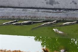
Location: 77º 8’ and 77º 17’ East Longitude and 8º 29’ and 8º 37’ . North Latitude. Area: 128 sq. km. Year of formation: 1958(GO(MS)871/58/06.08.1958 Climate: Temperature varies from 16ºto 35ºC Topography: Altitude ranging from 90 to 1868m . Highest Peak is Ponmudi ( 923m) Rainfall: Annual average rainfall is 2800mm. Drainage: The major rivers are Neyyar and its tributaries, Mullayar and Kallar Forest Types: Forest Types include West coast tropica evergreen, Southern hilltop triopical evergreen, Southern moist mixed deciduous forest, Southern tropical hill forests, southern sub-tropical savannahs and Reed brakes. Bio diversity: Common tree species like Terminalia paniculata, T.bellerica, Pterocarpus marsupium, Palaquium ellipticum, Mesua ferrea, Hopea parviflora, Bombax ceiba, Syzygium cumini, Lagerstroemia lanceolata, Adina cordifolia, Albizzia procera, Alstoniascholaris etc. There are 39 species of mammals, 176 sp. of birds, 30 species of reptiles, 17 species of amphibians and 40 species of fishes are reported from the sanctuary The common mammals found are, Tiger , Leopard, sloth bear, Elephant, sambar, barking deer, bonnet macaque, Nilgiri Langur, Nilgiri tahr etc. Approach: By Road –Kattakkada – 11 km. Thiruvananthapuram - 30 km. Nearest Railway Station: Thiruvananthapuram – 30km Nearest Airport: 35 km. Accomodation: IB – 2 beds Rest house, Meenmutty – 10 beds Youth Hostel (dormitory) – 20 beds Dormitory (Kombai)- 20 beds Special Attractions: One day trekking – Neyyar – Kombai – Meenmuty (Boating 9km, upto Kombai and guided trekking to Meenmuty falls (6km). Two day trekking (boating 9km , upto Kombai and guided trekking to Meenmuty falls & to Theerthakkara – Puivizhuthan Chuna (12km) overnight half at camp house Meenmytty and back Guided row boating up to deer park, trekking in forest Visit Crocodile rehabilitation center, Deer park, Lion safari park etc. Contact Address: The Wildlife Warden, Thiruvananthapuram Wildlife Division Forestry Complex, Rajiv Gandhi Nagar Vattiyoorkavu PO, Thiruvananthapuram Phone: 0471 2360762 Email: ww-tvm.for@kerala.gov.inPeechi – Vazhani Wildlife Sanctuary
Location: 76º 18’ and 76º 28’ East Longitude and 10º 28’ and 10º 38’ . North Latitude. Area: 125 sq. km. Year of formation: 1958(GO(MS)871/58/06.08.1958) Climate: m Temperature varies from 15º to 38ºC. Hottest period is March – April and coolest period is Dec- January. Topography: Altitude ranging from 45 to 900m . Highest Peak is Ponmudi (923m) Rainfall: Annual average rainfall is 3000mm.
Drainage: There are numerous streams, flowing over the entire PA, which join the three main rivers Kurumali, Manali, and Wadakkanchery. There are three vayals in the sanctuary viz, Paingottupadam (10ha), Pathrakkandam (1ha) and Pothiyadukky (5ha). There are two reservoirs, Peechi and Vazhani formed by construction of two dams across the Manalippuzha and Vadakkancheripuzha. The total area of the two reservoirs is 14.793 sq. km. Forest Types: Forest Types include Tropical Ever green Forests, Tropical Semi-evergreen forests, Moist Deciduous forests etc. Bio diversity: Common tree species are Erythrina indica, Eugenia hemispheria,Dalbergia latifolia, palanquium ellipticum, Mesua ferrea, Cullenia excelsa, Dipterocarpus indicus, Hopea parviflora, Dysoxylum malabaricum, Cedrella toona, Bombax ceiba, Syzygium cumini, Largerstroemia lanceolata, Adina cordifolia, Albizzia procera, alstonia scholaris Dalbergia latifolia, Xylia xylocarpa etc Newly described flora in the sanctuary are Aglalia malabarica, Phaeanthus malabaricus, Tarenna trichurensis, Cotton pedunculata, amomum microstephanum, and Orophea uniflora. There are 39 species of mammals, 176 sp. of birds, 30 species of reptiles, 17 species of amphibians and 40 species of fishes are reported from the sanctuary. The common forund are Tiger, Leopard, sloth bear, Elephant, sambar, barkingdeer, bonnet macaque, Nilgiri langur, slender loris porcupine etc. Approach: By Road –20 km from Thrissur Nearest Railway Station: Thrissur Nearest Airport: Nedumbassery - …. Kms. Accomodation: Dormitory (40beds) Contact Address: The Wild Life warden, Peechi Wildlife Division Peechi. P.O. Thrissur Phone: 0487 2699017 Mobile:9447979103 Email - ww-peechi@forest.kerala.gov.inParambikulam Wildlife Sanctuary
Parambikulam wildlife sanctuary with its panoramic landscape, meandering streams, extensive water spread of the reservoir, cascading waterfalls, rolling hills and valleys and wealth of biodiversity is one of the captivating places in Kerala. It is located in the Chittoor taluk of Palakkad district.
Location: 76º 35’ and 76º 50’ East Longitude and 10º 20’and 10º 26’ North Latitude Area: 277.40 sq.km. Year of formation: 1973 (GO(P)39/73/AD/12.02.0973) Climate: Temperature varies from 15ºC to 32ºC. Hottest period is March and coolest period is January. Topography: Altitude ranging form 300 to 1440m. Major peaks in the sanctuary are karimala (1438m), Pandaravarai(1290m), Vengoli (1120m) and Puliyarpadam (1010m) Rainfall: Rainfall varies from 1400 to 2300 mm. Drainage: Several streams flowing through the sanctuary drain the area. The sanctuary also possesses three man-made reservoirs namely, Parambikulam, Thunakadavu, and Peruvarippallam. Forest Types: Forest types include West Coast Tropical Ever green Forests, Moist Decidious Forests, Dry decidious forests, Teak plantations, Shola forests, Vayals. Bio-diversity: 1408 species of flowering plants which includes 67 species of orchids, 80 sp . of grass family and about 285 species of endemic, rare and endangered species. Haplothismia exannulata, amonotypic genus of Burmanniaceae rediscovered from the sanctuary after 1951. There are 36 species of mammals, 268 sp. Of birds , 61 species of reptiles, 16 species of amphigians, 47 species of fishes and 1049 species of insects in a sanctuary. The common animals found are Leopard, Elephant, Gaur, Spotted Deer, Sambar, Barkingdeer, Common Langur, Nilgiri Langur, Malabar giant squirrel, Sloth Bear and Wild dog. Common birds are Drongos, Bee-eaters, Treepies, Mynas, Woodpeckers, Kingfishers and birds of prey. Common reptiles are pythons, cobras, pitvipers, tortoises etc. The rare species include Tiger, Lion-Tailed macaque, Mouse deer, Nilgiri Tahr, Nilgiri Marten, Gread Pied Hornbill, Penisnsular Bay Owl, King Cobra, Flying Snake, Cane turtle Approach: By Road – 100km from Palakkad, 84 km from Coimbatore, and 38 km from Pollachi. Nearest Railway Station: Coimbatore (84 km), Palakkad (100km.) Accommodation: IB, Thunakadavu (4beds,) IB Anappady (4beds), Treetop Hut at Thunakadavu and Parambikulam (2beds each), Bison Valley Lodge, Parambikulam (6beds), Dormitory, Anappady (50beds), Community Hall, Parambikulam (30beds), Dr. Salim Ali Centre, Kuriarkutty (50beds) Special Attractions: 1. “Kannimara”, the ever-youthful teak tree, one of the oldest and largest trees in the world (about 360 years old.) 2. Thuvaiar water fall- a river cascading and emptying into the reservoir. 3. Excellent chances of sighting wildlife. 4. Three dams built during 1950s 5. Modern and interactive Wildlife Interpretation Centre 6. Medicinal plants demo garden and Interpretation Centre. Contact Address: The Wild Life Warden, Parambikulam Wildlife Division Anappad, Via Pollachi, Palakkad Phone: 04253 277233 Mobile:9447979102 E-mail: ww-parambikulam@forest.kerala.gov.in For more Details: www.parambikulam.orgWayanad Wildlife Sanctuary
Wayanad wildlife sanctuary is contiguous to the protected areas of Nagarhole and Bandipur of Karnataka on the north-east and Mudumalai of Tamilnadu on the south –east. Rich in biodiversity, the sanctuary is an integral part of the Nilgiri Biosphere Reserve, Interestingly, it was from here that Pazhassi Raja fought valiantly against the British.
Location: 76º 02’and 76º 27’ East Longitude and 11º 35 ‘ and 11º51’ North Latitude. Area: 344.44 sq. km. Year of formation: Declared a Sanctury during 1973 (GO(MS)182/73/AD/30.05.1973) Climate: Temperature varies from 13ºC to 32ºC Topography: Altitude ranging from 650 to 1150m . The highest peak is Karottimala (1158m) Rainfall: Average annual rainfall is2000mm. Drainage: Cherupuzha, Bavali puzha, Kabani river, Kannaram puzha, Kurichiat puzha, Chedalathu puzha etc Forest Types: The forest types include South Indian Moist Deciduous forests, West coast semi-evergreen forests and plantations of teak, eucalyptus and Grewelia Bio diversity: The major tree species are Tectona grandis, Terminalia sp, Dalbergia latifolia, Anogeissus latifolia, Grewia tiliaefolia, Adina cordifolia Cirmamum zeylanicum, Pterocarpus marsupium, Vateria indica, Largerstroemia lanceolata, Artocarpus hirsute, Macranga peltata etc. 45 species of mammals, 203 sp. of birds, 45 species of reptiles, 30 species of amphibians and 59 species of fishes are reported from the sanctuary Elephant, Gaur, Tiger, Panther,Sambar, Spotted deer, Barking deer, Wild boar, Sloth bear, Nilgiri langur, Bonnet macaque, Common langur, Wild dog, common otter, Malabar giant squirrel etc are the major mammals Approach: By Road – Kozhikode – 110 km Nearest Railway Station: Kozhikode Nearest Airport: kozhikode . Accomodation : IB (two rooms, 4 beds) . Dormitory – 50 beds Seramby – 2 nos, 2 rooms (2+1bed) Tourist Guest House (Govt.)and PWD Rest House at Sulthan Bathery (about 2 kms). There are also private hotels at S.Bathery Best season to visit: December to May Closure period: Open throughout the year Special Attractions: Water falls at Chedalayam. Elephant camp at Muthanga. Trekking and oneday halt package at Tholpetty. Contact Address: The Wild life Warden Wayanad Wildlife Division, Sulthan Bathery, Contact: Phone:04936 2620454 Mobile:8547603561 Email: ww-wynd.for@kerala.gov.inIdukki Wildlife Sanctuary
Idukki Wildlife Sanctuary which came into existende in 1976, is located in the Thodupuzha and Udumbanchola taluks in Idukki district. An enchanting place marked with steep mountains and undulating hills and valleys. The world famous Idukki arch dam and the vast increase the importance of the area.
Location: 76º 55’ and 77º 4’ 5’ East Longitude and 9º 45’ 30’ and 9º 53’ 30’ North Latitude. Area: 105.364sq.km. Year of formation: 1970 (GO.7898/FM3/76/AD/09.02.76) Climate: Temperature varies from 13ºC to 29ºC. Hottest period is March-April. Topography: Altitude ranging from 450to 1272 m. Highest peak is Vanjur Medu (1272m) Rainfall: Average rainfall is 3800 mm. Drainage: The major rivers flowing through the area at periyar and Cheruthoniar. The sanctuary consists of 33 sq,km of watervody of Idukki reservoir. Forest Types: Forest types include West Coast Tropical Evergreen forests, Semi Evergreen forests , Moist Deciduous Forests, Hill shoals and Grass Lands. Biodiversity: Major tree species are Depteocarpus indicus, Palanquium ellipticum, Calophyllum polyanthum, Vernonia arborea, Mesua Ferrea, Hopea parviflora, persea macrantha, Artocarpus hirsute, Lagerstroemia microcarpa, Cinnamomum zeylanicum, Tectona grandis, Dalbergia latifolia, Terminalia paniculata., T. bellerica,Grewiatiliacfolia, Ptcrocarpus Marsupium etc. The common animals found ar Elephant, Sambar, Barking Deer, Mouse deer, Bonnet macaque, Nilgiri Langur, Malabar giant squirrel, Wild dog, Wild boar, porcupine, jackal, Indian Giant Squirrel etc. Approach: By Road-Eranakulam-115 km. Kottayam – 120 Nearest Railway Station: Kottayam (120kms) Nearest Airport: Nedumbassery (120kms) Accommodation: IB, Vellappara (6beds), Dormitory, Vellappara (50beds) IB at Vazhathopu owned by Kerala State Electricity Board Private hotels at Cheruthoni, Kattappana, Thodupuzha Contact Address; The Wild Life Warden, Idukki Wildlife Division Painavu P.O. Idukki – 685603 Phone: 0486 2232271 Mobile:9447979094 E-mail: ww-idukki@forest.kerala.gov.in 3. The Asst. Wildlife Warden. Vellapara, Painavu P.O, Idukki Phone : 04862 322025 E-mail - ro-idukki@forest.kerala.gov.inPeppara Wildlife Sanctuary
The sanctuary constitutes he catchments of peppara dam constructed across the Karamana river and commissioned during 1983 to augment the drinking water supply to Thiruvananthapuram city and suburban areas.
Location: 77 6’ 50” and 77 14’ 5” East Longitude and 8 34’ 30” and 8 41’ 25” North Latitude Area: 53 sq km Year of formation: 1983 Climate: Temperature varies from 16 C to 35 C. Topography: Altitude ranging from 100 to 1717 m. The major peaks in the sanctuary are Chemmunjimottai (1717 m), Athirumalai 1594 m, Arumukhamkunnu (1457 m), Koviltherimalai (1313 m) and Nachiyadikunnu (957 m). Rainfall: Annual average rainfall is 2500 mm Drainage: The major rivers are Karamana river and its tributaries. The peppara reservoir is of an area of 5.82 sq .km. Forest Types: Forest types include West coast tropical evergreen, Southen hilltop tropical evergreen, West cast semi-evergreen, Southern moist mixed deciduous forest, Myristica swamp forest, sub-montane hill valley swamp forest etc. Biodiversity: Common tree species are Terminalia paniculta, T. bellerica, PTEROCARPUS MARSUPIUM, Palaquium ellipticum, Mesua ferrea, Hopea parviflora, Bombax ceiba, Syzyguium cummini, Lagerstroemia lanceolata, Albizzia procera, Alstonia scholaris, etc. 43 species of mammals, 233 sp. of birds, 46 species of reptiles, 13 species of amphibians and 27 species of fishes are reported from the sanctuary. The common mammals found are Tiger, Leopard, Sloth bear, Elephant, Sambar barking Deer, bonnet Macaque, Nilgiri langur, Nilgiri tahr etc. Approach: By Road – Thiruvananthapuram – 44km Nearest Railway Station: – Thiruvananthapuram – 44km Nearest Airport: – Thiruvananthapuram – 49 km Accommodation: - No facilities by the Department. IB of Kerala Water Authority is very near to the headquarters. Best season to visit: January to March Closure Period : Open throughout the year Special Attractions: Trekking to forest area – Bonafalls, Vazahuvanthole water falls,Kalarkad waterfalls, visit to settlement areas etc. Contact Address: The Wildlife Warden Thiruvananthapuram Wildlife Division, Forestry Complex, Rajiv Gandhi Nagar, Vattiyorkavu P.O, Thiruvananthapuram Phone: 0471 2360762 Email - ww-tvm.for@kerala.gov.inShendurney Wildlife Sanctuary
Shendurney wildlife sanctuafy, part of Agsthyamali Biosphere Reserve, owes its name to the endemic species, Ghuta Travancorica, locally known as ‘Chenkurunji’. The sanctuary is a valley of green splendour acclaimed for its rich biodiversity lying on either side of the Shendurney river.
Location: 76º 59’ 30 “ and 77º 16’ 30 “ East Longitude and 8º 44 ‘ and 9º14’ North Latitude. Area: 171 sq. km. Year of formation: 1984 Climate: Temperature varies from 17ºto 35ºC Topography: Altitude ranging from 100 to 1550m . Highest Peak is Alwarkurichi (1550m) Rainfall: Annual rainfall varies from 2600 to 3000mm. Drainage: The major rivers are Shendurney, Kazhuthuruthy and Kulathupuzha which join together to form the Kallada river. Important tributaries are Umayar, Parappar, Uruliar, and Pasmankandamthodu. Forest Types: Forest Types include West coast tropicalevergreen, Southern hilltop triopical evergreen, West coast tropical semi-evergreen, Southern secondary moist mixed deciduous forest, Myristica swamp forest, Southern sub-tropical hill forests, Reed brakes and grassland. Bio diversity: Common tree species are Gluta travancorica, Terminalia paniculata, T.ballerica, Pterocarpus marsupium, Cullenia exarillita, Palanquium ellipticum, Mesuaferrea, Poeciloneuron indicum, Elaeocarpus tuberculata, Mangifera indica, Vateria indica, Dipterocarpus indicus, Vitex altissima etc. 34 species of mammals, 245 sp. of birds, 36 species of reptiles, 22 species of amphibians and 42 species of fishes are reported from the sanctuary The common mammals found are, Elephant, Gaur, Sambar, Wild bear, Malabar giant squirrel, Nilgiri langur, Lion-Tailed macaque etc. etc. Approach: By Road – Thiruvananthapuram – 70 km Kollam - 70 km Shenkottai – 30 Km. Nearest Railway Station: Kollam – 70 Km. Shenkottai – 30 km Nearest Airport: Thiruvananthapuram – 75 km. Accomodation: No facilities by the Department. IB of kerala Water authority is very near to the headquarters. Best season to visit: October- Feburary Closure Period: Open throughout the year Special Attractions: Trekking to the forests. The eco-tourism packages offered a present are Dharbakulam trail, Kallar trail, and Kattilappara – Choodal bird watching trail. Boating in the reservoir operated jointly by the Department and Thenmala Ecotourism Promotion Society. Contact Address: The Wild life Warden, Shendurney Wildlife Division Thenmala Dam P.O. Phone : 0475 2344600 Mobile:9447979081 Email - ww-shendurney@forest.kerala.gov.inChinnar Wildlife Sanctuary

Chinnar wild life sanctuary located in the rain shadow region of the Western Ghats is the second habitat for the endangered Grizzled giant squirrel in India. The sanctuary has the unique throny scrub forest with xerophytic species.
Location: 77º 15’ and 77º 17 East Longitude and 10º 15 ‘ and 10º21’ North Latitude. Area: 90.422 sq. km. Year of formation: 1984 Climate: Temperature varies from 18ºC to 25ºC Topography: Altitude ranging from 500 to 2400m . Major Peaks in the Sanctuary are Kottakombumalai (2144 m), Vellaikal malai (1863 m) and Viriyoottu malai (1845m) Rainfall: Average annual rainfall is 100mm. Forest Types: The major portion of the area is covered with grass lands. There were also several patches of shoals. Bio diversity: The major species in the throny scrub forests are Acacia arabica, Acacia leucofolia, Acacia concinna, Prosporis juliflora, and Opuntia dillenii. Dry deciduous species include Santallum album, Anogeissus latifolia, Terminalia arjuna, Tamarindus indica, Pongamia glabra, Dalbergia latifolia, Tectona grandis, Lagerstroemia laneolata, Cassia fistula, Terminalia bellerica, Emblica officianalis etc. High shoal and wetland species include Rhododendron nilagiricum, Elaeocarpus, recurvatus, Strobilanthus kunthianus etc. 34 species of mammals, 245 sp. of birds, 36 species of reptiles, 22 species of amphibians and 42 species of fishes are reported from the sanctuary Elephant, Gaur, panther, spotted deer, Sambar, Grizzled giant squirrel, Hanuman monkey etc are the common mammals. Approach: By Road – Kochi _ 200km Pollachi – 60 Km. Nearest Railway Station: Pollachi- 60 Km. Nearest Airport: Nedumbassery . Accomodation : IB at Chinnar . Dormitory at Chinnar Best season to visit: October-November Closure period: Open throughout the year Contact Address: The Wildlife Warden, Eravikulam National Park Munnar P.O, Idukki, Kerala, PIN - 685 612 Phone: 04865 231587 Mobile:9447979093 Email - ww-munnar@forest.kerala.gov.in For Information on tourism please contact : Information Assistant -8301024187Chimmony Wild life Sanctuary
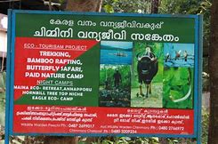
Chimmony Wildlife sanctuary established in 1984 is situated in the Mukundapuram Taluk of Thrissur District. The headquarters of the sanctuary is at Echippara which is 28 kms away from the Amballoor village in the north direction. Amballoor is 12kms away from Thrissur town in the south direction
Location: 76º 31’ and 76º 37’ East Longitude and 10º 22’ and 10º 26’ North Latitude, Area: 85.067 sq.km. Year of formation: 1984 Climate: Temperature varies from 15º C to 36º C. Hottest period is March – April. Topography: Altitude ranging from 40 to 1110m. Highest peak is Punda peak (1116m) Rainfall: Annual average rainfall is 2980mm. Drainage: There is a dam constructed across the Chimmony river at 75 m above the sea level. Consequent to the construction of th dam, an artificial lake has been formed with an area of 10 sq.km. and 20 m depth. The sanctuary consists of the watershed areas of Kunumali and Mupliam rivers. Forest Types: Forest types include Tropical Evergreen Forests, Tropical Semi-evergreen forests, Moist Deciduous Forests etc. Bio diversity: Common tree species are Palaquium ellipticum, Mesua ferrea, Cullenia exarillitia, Dipterocarpus indicus, Hopea parviflora, Dysoxylum, malabaricum, Cedrellatoona, Bombax ceiba, Syzigium cumini, Largerstroemia lanceolata, Adina cordifolia, Albizzia procera, alstoniascholaris, Dalbergia latifolia, Xylia xylocarpa etc. There are 39 species of mammals, 160 sp of birds, 25 species of reptiles, 14 species of amphibians, and 31 species of fishes are reported from the sanctuary. The common mammals found are Tiger, Leopard, sloth bear, Elephant, Sambar, barking deer, bonnet macaque, Nilgiri Langur, slender loris porcupine etc. Approach: By Road – 45 km from Thrissur Nearest Railway Station : Thrissur (48kms) Neareat Airport : Nedumbassery – 60 kms Accomodation: Dormitory (40beds) Contact Address: The Wild Life Warden Peechi Wildlife Division, Peechi. P.O, Thrissur Phone: 0487 2699017 Mobile:9447979103 Email - ww-peechi@forest.kerala.gov.inAralam Wildlife Sanctuary
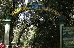
Located on the western slopes of Western Ghats, Aralam is the northern most wildlife sanctuary of Kerala.
Location: 75º 47’and 75º57’ East Longitude and 11º 54’ and 11º59’ North Latitude. Area: 55 sq. km. Year of formation: Declared a Sanctury during 1984 Climate: Temperature varies from 110C to 400ºC Topography: Altitude ranging from 650 to 1150m. Rainfall: Rainfall varies from 3700 to 5000mm. Drainage: The Cheenkannipuzha forms the main drainage system on the southern side. Narikkadavu thodu, Kurukkathodu and Meenumuttithodu from the northern upper reaches flow southwards to join Cheenkannipuzha. Forest Types: The forest types include West Coast tropical evergreen forest. , West coast semi-evergreen forests, South Indian moist deciduous forest, Southern hilltop evergreen forest and plantations Bio diversity: The major tree species are Artiocarpus heterophyllus, Bishofia javanica, Calophyllum elatum, Cannarium strictum,Cullenia exarillita, Dipterocarpus sp, Drypetes elata, Dysoxylum malabaricum, Elaeocarpus tuberculatus, Holigarna arnottiana, Mesua ferrea, Palanquium ellipticum Bombax ceiba, Dalbergia latifolia, Grewia tiliaefolia,Terminalia sp etc. 23 species of mammals, 188 sp. of birds, 22 species of reptiles, 16 species of amphibians and 39 species of fishes are reported from the sanctuary Elephant, Gaur, Tiger, Panther,Sambar, Spotted deer, Barking deer, Wild boar, Sloth bear, Nilgiri langur, Bonnet macaque, Common langur, Wild dog, common otter, Malabar giant squirrel etc are the major mammals Approach: By Road – Thalasseri– 45 km Kannur – 45 km Nearest Railway Station: Thalasseri Nearest Airport: Kozhikode (113kms) Accomodation : IB (two rooms, 4 beds) . Dormitory – 50 beds Best season to visit: November to May Closure period: Open throughout the year Special Attractions: Trekking in the sanctuary. Contact Address: The Wildlife Warden, Aralam Wildlife Division,Iritty P.O Phone: 0490 2493160 Mobile:9447979101 E-mail: ww-aralam@forest.kerala.gov.inMalabar Wildlife Sanctuary

The sanctuary is part of the western ghats, a biodiversity hotspot. It also comes under the Nilgiri Biosphere Reserve and forms a part of the Wayanad Elephant Reserve.
The sanctuary area constitutes the watersheds of Kuttiady River. The reservoirs at Kakkayam, Peruvannamuzhy and Banasuramala are lifeline of the inhabitants in Kozhikode district as they are the source of drinking water. Electricity is also generated from the hydro-electric project. The picturesque dam site, unique climate, richness of biodiversity and gorgeous waterfalls of Urakkuzhi offers good eco tourism potential and is an important tourist destination of this region. The forest catchment of the sanctuary is a rich conservatory of the basic resource of life “Water”. The reservoirs, the rivers and the projects in the area, sustain the water and power (electric) need of Kozhikode and Malabar. Location and Extent The Malabar Wildlife Sanctuary covering a total of 74.215015 sq.km extends between 11degree 75’ and 11degree 76 ‘North latitude and between 76 degree 20’ and 75 degree 38’ East longitude.The sanctuary is located in Chakkittappara and Koorachundu revenue villages of Quilandy Taluk. The forests lie on the Northwest slopes of the Western Ghats contiguous with the forests of Ladysmith Reserved Forests and Kurichiar mala of Kalpetta Forest Range of South Wayanad Forest Division. The sanctuary lies along the boundary of Kozhikode district with Wayanad district to the north of the Tamarassery – Kalpetta Ghats. Climate Both south-west and north-east monsoons bring rains to this region. South West monsoon is heavier and more violent. The 1992 and 2007 monsoon season was unusually heavy and violent causing considerable damage to forest, cultivations and property. The south west monsoon starts in the first week of June, preceded by a few pre monsoon showers in April and May. The heaviest fall occurs in July and August. The north east monsoon is generally weak and characterized by sporadic rains during afternoons in the month of October-November. December to March is generally dry months. Temperature The temperature varies from 16° C to 38° C, diurnal and seasonal variation being moderate, as typical of the tropical nature. As the altitude increases, the variation is comparatively minimal which is between 80c and 250c. The hottest months are April and May. December to February is relatively cool. Humidity At the hills, the humidity varies from 60% to 100%. In the plains and foot of the hills, humidity varies from 50% to 90%, reaching saturation point during monsoon season. Mist is frequent in the higher elevation, with heavy deposition during December - February. Drainage and Rivers There are many seasonal and perennial streams that join the reservoirs constructed across the Kuttiady River, the largest river in Kozhikode district (Murat River in olden days). The existence of forests tract in the upstream catchments greatly influences the water quality in the downstream and reservoirs. It has a catchment area of about 583 km2 and is estimated to discharge 1224.30 MCM of water annually. Other drainage systems that join the Kuttiady puzha are: Onipuzha ,Alerimuzhi thodu or Alampara thodu ,Kadantharapuzha ,Muthuveedu puzha Flora The Sanctuary has diverse vegetation types. These are the West-coast Tropical Evergreen, West-coast Semi evergreen, Southern Moist Mixed Deciduous, Southern Hill-top Evergreen forests, Grasslands, and Marshy grasslands (Vayals).he variety of vegetation types harbours more than 680 species of flowering plants including 226 species endemic to southern Western Ghats (about 30%). Sixty nine species of plants are placed under various threat categories.Viable populations of tree species like Meteoromyrtus wynaadensis, Syzygium stocksii, Eugenia argentea (previously considered extinct), Syzygium floccosum, Atuna indica (previously considered extinct), Coffea crassifolia (previously considered extinct), Garcinia malabarica, Humboldtia brunonis var. rakthapushpa. Atuna indica, Eugenia argentea and Humboldtia brunonis var. rakthapushpa occur only in this sanctuary. More than 200 species of medicinal plants are reported in this sanctuary. Fifty two species of bryophytes including 28 liverworts and 24 mosses are reported. Sixteen of these are new to Kerala and 9 new to Peninsular India. Several of them are reported to occur only in this Sanctuary area. Fifty ferns reported from the area include three tree ferns. Fauna Forty one species of mammals are reported in the area, which include 6 Western Ghats endemics. Of the 179 species of birds, 10 are endemics, 6 range restricted and 5 globally threatened species. Thirteen of these are listed in the schedule I of the Indian Wildlife Protection Act (1972). Preliminary surveys indicate the presence of 36 species of reptiles including 8 Western Ghats endemics. This forested habitat is known to be an ideal haunt for King Cobra, the largest venomous snake in the world. Thirty eight species of amphibians are known from this area of which 26 are Western Ghats endemics. The amphibians include the recently discovered Philautus ponmudi, P. anili, P. tuberohumerus, P. neurostegona, P. ochlandrae, P. akroparallagi and P. chromasynhysi . The type locality for P. ochlandrae is the reed brakes of Kakkayam dam site, the only known site for this species.The streams of Kakkayam support 52 species of fishes including 21 Western Ghats endemics. The hill stream habitats of Kakkayam are also known for the endangered Mahseer, Tor khudree. A total of 143 species of butterflies including 8 Western Ghats endemics are known from this area. Fifty one species of Dragon flies which include 11 species of Western endemics are reported from the region. Eco Tourism The southern portions surrounding the reservoirs of this sanctuary are major tourist destinations in Kozhikode district. Visitor management and eco restitution activities are carried out through the Vana Samarakshana Samithies (VSS) at the ecotourism centres at Peruvannmuzhi and Kakkayam. At Kakkayam, the Urakkuzhy water fall and crystal clear streams are major attractions. At Peruvannamuzhy the dam, the garden, the animal rehabilitation centre and the Indian Institute of Spices Research are the areas frequented by the visitors . About 40000 people visit the area annually. Vehicles are not permitted to enter the Sanctuary. Attractions 1. Urakkuzhy waterfalls. 2. Peruvannamuzhi and Kakkayam dam and reservoirs. 3. Adventure trekking 4. Wild life rehabilitation centre Contact Divisional Forest Officer Kozhikode 6 th Floor, B-Block Civil Station, Kozhikode - 673020. DFO, Kozhikkode Tel : 0495 2374450 Mobile : 9447979073 Range Officer Peruvannamoozhy Range Peruvannamuzhi P.O. Kozhikode - 28 Tel : 0496 2619014Thattekkadu Bird Sanctuary
Year of formation: 1983 Climate: Temperature varies from 20ºC to 32ºC. Hottest period is April-May and coolest period is December- January Topography: Altitude ranging from 35 to 488 m. Major peaks in the sanctuary are Thoppimudi and Nyayapillimudi. Rainfall: Rainfall varies from 1400 to 2300 mm. Drainage: Several marshy land/vayals are found in certain areas bordering with the Periyar and Idamalayar Rivers. A part pf the sanctuary is sumerge due to Bhoothathankettu Irrigation Dam. Forest Types: Forest Types includes Tropical Evergreen Forests, Tropical Semi-evergreen forests, Moist Decidious forests, Riparian Forests, Plantations of Teak, Rosewood, Mahagony and Fruit Orchard.
Bio diversity: Common tree species are Eleocarpus tuberculatus, Canarium strictum, Evodia aiunenkanda, Nephelium longata, Dipterocarpus indicus, Palanquium ellipticum, Myristica dactyloides, Hopea parviflora, Tetrameles mudiflora, Dysoxylum malabaricum and Lagerstroemia microcarpa, Tectona grandis, Dalbergia latifolia, Terminalia bellarica, T.paniculata, T.chebula, Bridelia retusa, Emblica officinalis, Grewia tiliaefolia etc There are 34 species of mammals, 270 sp of birds,30 species of reptiles, 15 species of amphigians and 47 species of fishes are reported from the sanctuary. The common animals found are Leopard, sloth bear., porcupine etc. Elephants are occasional vistors Common birds are Indian roller, Cuckoo, common snipe, crow phesant, grey drongo, Malabar trogon, wood peckers, lare pied wagtail, Indian hill myna etc. Rare birds found are Ceylon Frogmouth, Bourdillon’s Long eared Indian Nightjar, Peninsular Bay owl, Crimson throated barbet, Malabar hornbill, Malabar horn bill, Malabar shama, Greyheaded fising eagle etc. Approach: By Road – 13km from Kothamangalam, kottayam(83km) Nearest railway station: Aluva(48kms) Nearest Airport: Kochi – 71 km. Accomodation: IB, (6beds), Dormitory (50beds) One PWD Rest House at Kothamangalam Contact Address: The Wildlife Warden, Idukki Wild life Division, Painavu.P.O, Idukki – 685 603 Phone: 0486 2232271 Mobile:9447979094 E-mail: ww-idukki@forest.kerala.gov.in The Asst Wildlife Warden, Thattekkad bird Sanctuary Njayappilli P.O, Kothamangalam, Phone: 0485 2588302 Email - ro-thattekkad@forest.kerala.gov.inKadalundy Vallikunnu Community Reserve
Area- 1.5sq.km Year of formation- 2007 Districts- Kozhikkode and Malappuram
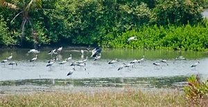
The Kadalundi estuary is located at the mouth of the river Kada-lundi that drains into the Arabian Sea onthe west coast of Kerala. Apart from scattered patches of mangroves, the estuary is bordered by human habitation and coconut groves. Around 8 ha of mudflats, exposed during low tides, offers potential foraging ground for several hundreds of wintering and resident water birds, particularly waders.It also provides significant socio-economic and livelihood services for the people around (fishing, oyster farming andsand mining). A total of 110 species of water birds including 53 migrants have been recorded. The estuary is one of the few habitats on the west coast where a small population of Lesser Sand Plover (Charadrius mongolus), Whimbrel (Numenius phaeopus) and Common Redshank (Tringa totanus) are observed to over-winter. A good regional population of Brown-headed Gulls (Larus brunnicephalus), Black-headed Gulls (Larus ridibundus) and the critically endangered Spoon-billed Sandpiper (Eurynorhynchus pygmacus). Considering its importance in terms of diversity of wetland birds and heavy anthropogenic pressures, the estuary has been officially declared as the Kadalundi Vallikunnu community reserve.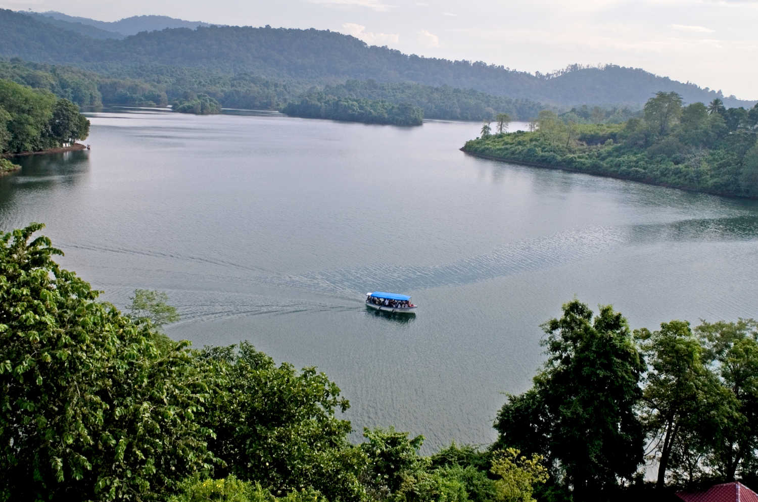
Honeymoon Tour Packages
Extreme Privacy Love @ Kerala Amazing Kerala Honeymoon Kerala Romance @ Hills
Vacation Tour Packages
Water Carnival Sunrise & Sunset Enchanting Kerala Leisure Kerala Hills to Beach Quick Kerala
Family Tour Packages
Hills & Lagoons Hills & Beaches Vibrant Kerala Exclusive Kerala Full Round
Beach Tour Packages
Beach Fantasy Pristine Beaches Beach & Backwater Weekend Beach Sun N Sand
Hillstation Tour Packages
Enchanting Hills Mist Valley Hills & Wildlife Essential Kerala Weekend @ Hills Morning Drizzle
Wildlife Tour Packages
Go Wild Birds Paradise Wild Weekend Extreme Wilderness Love Tiger
Houseboat Tour Packages
Kumarakom Round Alappuzha Round Alappuzha to Kumarakom Kumarakom to Cochin Kumarakom to Alappuzha
Backwater Tour Packages
Serene Lake Lake & Lake Hide Away Wanderlust Extreme Pleasure